On Land...On Sea...On Foot...On Bikes...On Harley's...On 4 wheels...Places to see places to go...visits, stops, weekend breaks, holidays...On Land...On Sea...On Foot...On Bikes...On Harley's...On 4 wheels...Places to see places to go...visits, stops, weekend breaks, holidays...On Land...On Sea...On Foot...On Bikes...On Harley's...On 4 wheels...Places to see places to go...visits, stops, weekend breaks, holidays...On Land...On Sea...On Foot...On Bikes...On Harley's...On 4 wheels...Places to see places to go...visits, stops, weekend breaks, holidays...On Land...On Sea...On Foot...On Bikes...On Harley's...On 4 wheels...Places to see places to go...visits, stops, weekend breaks, holidays

Ceres Karoo


We set of from Hout Bay at 0700hrs and drove along the coast into Cape Town then along the N1 to Worcester then turned left for Ceres. Once in Ceres a search for breakfast failed so we did a diesel top-up, and soon we're on the road to Prince Alfred Hamlet, a 9km stretch from Ceres along the R303, after which the road climbs steeply up the Gydo Pass.
On the top of which we stopped for our breakfast, hot coffee and sticky chery fruit cake. We leave the fertile Ceres valley - surrounded by snow-covered mountain peaks - behind us. At a lookout point near the summit of the pass, there's a camper with its blinds still tightly drawn. These people chose a great spot to wake up in - you'd have to travel far and wide to find a more beautiful view.
Our route veers to the right at Op-die-Berg, some 36km beyond Prince Alfred Hamlet, on the road that leads to the Ceres Karoo.
We passed Boplass Cottage a thatched dwelling with a plaque that reveals the estate was allotted to lzak Wilhelmus van der Menrve (ancestor of the Afrikaans poet Boerneef) in 1743 as grazing land. Next to the outbuildings is a memorial wall commemorating all the Van der Menrues who died on this acre of land. There are four with the initials l.W.
From here on the surroundings begin to change. Massive piles of rock decorate the veld, the perfect place for a game of cowboys and Indians. The strip of tar ends at a fork in the road; we proceed to the right as directed by the Kagga Kamma signpost and enter the Swartruggens conservation area. A little way on we come to a weird sandy patch in the veld that forms a couple of low dunes alongside the road, but there's no time to wonder about it because the bakkie suddenly pushes us into our backrests. Ah, the Katbakkies Pass... and surprisingly it's not a dirt road! Honestly, I was seldom as thankful for a strip of tar as this one. Who knows how people managed to slip and slide their way up the pass before it was tarred in 1999? The sheer edges grin with evil glee around every turn, so it's best to look into the distance (that's if you're not the driver, of course). It's a short but formidable pass (about 1.5km long). Like gargoyles on old cathedrals, phantom faces in the rocks keep watch over us the whole way. And your imagination freely takes flight.


Beyond the pass is the turn-off to the Kagga Kamma Reserve, and a few kilometers further on are two derelict cottages. An ideal place to stretch your legs in the sun, talking about the lives of long dead shepherds and farmers who may have lived here once.
Shortly thereafter we twist down the 3km of tight curves on the Peerboomkloof Pass. The sun is directly overhead and every flower has folded open to display beautiful colours. Sheets of vygies add dabs of purple to the ridges, and patches of afrikaners and marigolds intermingle in tufts of orange. Aloes burst from their seams and over their tops you see three, four, five shades of the distant blue ridges and mountains we still have to cross today. About 15kms beyond the ruins the road joins the wellknown R355 - apparently the longest gravel road in South Africa. The road has been described as rock hard and glossy, we found it dug up and full of construction workers and their lorries. After about 25klms we turn right towards the Tankwa Karoo National Park.
Aside from a few falcons, the veld has shown little sign of life. (Or should we count the little dead snake we saw?) We start seeing more and more flocks of sheep, their cloudy white bodies contrasted against the shrubbery like feta crumbs in a green salad. A high fence on the right indicates that there should also be wildlife, but we have not seen any. The veld grows increasingly parched and flat.
We drive through the Tankwa Karoo National Park and up and over the breath taking Gannaga Pass, before driving into Middelpos. Aside from the hotel, a forlorn tennis court, a yellowed golf, a post office , a shop and two diesel pumps, there isn't much in Middelpos. Yes. the SAPD has a presence here and the village has its own school, but the only citizens we encounter are the Van der Westhuizen family. Koos owns almost every propefty in Middelpos and that makes him the unofficial mayor. Long before him a Mr Tomlinson owned the general dealer and, at the turn of the previous century, the grandfather of the actor and writer Sir Anthony Sher also occupied the throne here.

The town grew slowly, and after 1970 it exchanged hands twice more before the Van der
Westhuizens took over on 1 August 1980.
At dinner in the hotel I start to apprecrate the current regime - the plate of country food Koos's wife, Helene, places in front of us is enough to make any mother-in-law weep with joy and approval: Roast potatoes, quince, chicken drumsticks, bobotie and rice, cabbage with cheese sauce... and malva pudding with custard for desert. I'd drive all the way to Middelpos just for this.
After finishing a bottle of red in front of the TV we went to bed. Early the next morning we visit Koos's boerbull enclosure he breeds the and has 27, all friendly types.

Before leaving for Sutherland, we observe a moment of silence at the graves of the English
soldiers who perished near here towards the end of the Anglo- Boer War.
The R354 between Middelpos and Sutherland is a badly corrugated road and unless your vehicle is heavily loaded, you'll have a jolly time bouncing and snaking around, fortunately we had the dogs in the back to keep us on the road. This is the heart of the Roggeveld, even though the wild rye which gives the area its name hasn't been seen here for decades. lt's hard to believe that this land once looked like the Swartland's waving wheat fields. The natural veld survived the assault of grazing, but not the wild rye.
Halfway, we pass Fransplaas where sheep's milk cheese is manufactured under the name Terra Nova. We bomb past as it looks to be a long way up an even more bumpy track. we continue on to where the Salt telescope and its companions await us on the hill.

Daylight and stargazing don't go together and night excursions to the Salt telescope are booked five months ahead in any event. We had managed to book a night visit but as luck would have it the weather was not going to play ball, so we opten for an afternnon visit which was facinating if for no other reason that the cloud formations.
Sutherland, named after visiting cleric Rev Henry Sutherland (1790-1879), has beautiful stone houses and a church that was used as a fort for eight months during the Anglo-Boer War. Vernon Marais, owner of one of the town's many guesthouses, tells us that the cornerstone of the church was laid in I899, but construction lasted only 18 months because first diphtheria hit the district and shorlly thereatter the British. This is why the church was repaired after the war and open 1903.
We spend a nice night at the Sutherland Hotel which is going through a massive refit under its new owner, a lad from Sutherland who spent 30 years as a finacial advisor in Worcester before buying the hotel and returning to his home town. Next day we set off for home first down the Verlatekloof Pass, It takes careful driving through the many fallen rocks in the left lane of the pass. Then something rare happened a thunderstorm dumped gallons of water and like a biblical miracle this parched desert sprang to life. Suddenly dents in the ground became streams and then rivers, even waterfall appears tumbling over the rock formations.
Before long we were back at the N1 where we turned right and drove back to Cape Town and Hout Bay. A round trip of 670 kilometers most of which was on gravel.

On Land...On Sea...On Foot...On Bikes...On Harley's...On 4 wheels...Places to see places to go...visits, stops, weekend breaks, holidays...On Land...On Sea...On Foot...On Bikes...On Harley's...On 4 wheels...Places to see places to go...visits, stops, weekend breaks, holidays...On Land...On Sea...On Foot...On Bikes...On Harley's...On 4 wheels...Places to see places to go...visits, stops, weekend breaks, holidays...On Land...On Sea...On Foot...On Bikes...On Harley's...On 4 wheels...Places to see places to go...visits, stops, weekend breaks, holidays...On Land...On Sea...On Foot...On Bikes...On Harley's...On 4 wheels...Places to see places to go...visits, stops, weekend breaks, holidays

On Land...On Sea...On Foot...On Bikes...On Harley's...On 4 wheels...Places to see places to go...visits, stops, weekend breaks, holidays...On Land...On Sea...On Foot...On Bikes...On Harley's...On 4 wheels...Places to see places to go...visits, stops, weekend breaks, holidays...On Land...On Sea...On Foot...On Bikes...On Harley's...On 4 wheels...Places to see places to go...visits, stops, weekend breaks, holidays...On Land...On Sea...On Foot...On Bikes...On Harley's...On 4 wheels...Places to see places to go...visits, stops, weekend breaks, holidays...On Land...On Sea...On Foot...On Bikes...On Harley's...On 4 wheels...Places to see places to go...visits, stops, weekend breaks, holidays

Swartberg Pass


At the end of March 2007, Carol and I took the dogs up into the Karoo for a few days, our main aim was to drive the Swartberg Pass, a twisty gravel road over the Swartberg mountains.
We stopped in a self catering cottage in Calitzdorp, there was a number of cottages grouped together around a courtyard. On the night we arrived we sat outside and had a braai with the owners and some of the other guests, who were there to visit the larges Afrikaans Arts Festival in the worls at nearby Outdshoorn.
The lady owner of the cottage made mustards and we bought a slection from her range, which included chilli, garlic, chardonnay with sun dried tomatoes.
On the morning of day three Noah was sitting out on the veradah with me, I left him for a second, during which the gardener suddenly appeared and startled Noah. Noah went for him and as looked out the cottage door, I just caught sight of Noah in mid air about to land on the back of a running away gardener. Fortunately the gardener was not hurt just shaken, Noah came straight back when I shouted at him.
It was very very hot during this visit, in the low 40c and it was all to much for Solomon who was struggling with the heat, the truck and just about everything. So we cut our visit short by a day and took a slow drive home.
But this is definately an area we will visit again as there are many gravel roads that just wonder all over the Karoo.


The 27 km Swartberg Pass is considered one of the most impressive mountain passes in the world: an untarred road that winds to the summit 1583 meters above sea level in steep zigzags and sudden switchbacks with breathtaking views at every turn. The road is supported in places by hand-packed stone walls, a trademark of Thomas Charles Bain, the brilliant road engineer of the 19th Century. Along the way there are relics of old prisons, tollhouses, and Way stations that bear historic testimony to past adventures. Often covered with snow in winter, the mountain's microclimate supports fynbos and a rich bird life, in contrast with the arid-zone flora and fauna outside its cool shady kloofs. The Swartberg Pass was declared a National Monument in its Centenary year, 1988. Those who have crossed the pass will never forget it.


On the far side of the pass we found some spectacular rock formations and an attractive mountain stream.

Having successfully crossed the Swartberg Pass we drove into the very nice Karoo town of Prince Albert and had lunch. Prince Albert is crammed with really nice cafe's, coffee shops and restuarants, so its a good place to visit and well, eat.

After lunch we drove back to our accommodation in Calitzdorp, via Outdshoorn and the Meiringspoort pass.

Meiringspoort is a deep cleft through the seemingly impenetrable Swartberg Mountain range. This natural passage forms a convenient link between the Great and Little Karoo. Soaring cliff walls with spectacular rock formations line the 25 km tarred road, which winds along the floor of the gorge, crossing the Groot River 25 times. Entry to the Poort is via Klaarstroom, 55 kms east of Prince Albert, en route to Oudtshoorn and the coast. Hardy plants, including indigenous pelargoniums, cling to the precarious rock faces while birds, baboons and smaller fauna abound in the protected kloofs & crevices. Among the most scenic spots is the waterfall tumbling into a dark pool that, according to legend, is bottomless. In Meiringspoort one feels insignificant against the overwhelming grandeur of the surroundings. Driving through this Poort with its winding road, the traveller is enchanted by the scenery with a kaleidoscope of every changing colour. The richness of the vegetation along the river will intrigue plant lovers and birdwatchers will be amazed at the bird life. Meiringspoort was originally opened to traffic on the 3rd March 1858.

Calitzdorp is the Port capital of South Africa and you can visit many of the vineyards who produce this fortified red wine.

This fertile valley was originally a lake. The soil is mainly alluvial and agricultural crops are grown 1 km on either side of the rivers (Nel’s and Gamka – lion in khoi).

Early writings prove that the khoi called Kannaland ‘the valley with no grass’. Evidence of early San and Khoi peoples are evident in numerous rock paintings found In the surrounding mountains.

In 1821, land was granted to JJ and MC Calitz who named it Buffelsvlei. This name was derived from the local vegetation and animals found here.

In 1853, the Calitz’s donated land for a church and school to be built, as Oudtshoorn proved to be too far to travel for their monthly ‘Nagmaal”.

In 1910, the population was 4000 and a larger church and school were needed. Both buildings were completed in 1912 The church has a neo-Byzantine style with a Marseilles roof. It is a good example of the sandstone architecture of the ostrich-era In the little Karoo. It was declared a national monument in 1991.

Also in 1912 , building commenced on the old Standard Bank building , presently housing the museum , and the Calitzdorp dam. This dam wall was the first of many to be built in South Africa ,using cement.
Subsequent drought, the great flu epidemic, and the collapse of the ostrich feather industry, played havoc amongst the community.

New hope however, came to Calitzdorp in the form of a Railway line (in 1924) and Electrification (in 1937 ), as well as the construction of the first cement road between Calitzdorp and Oudtshoorn ( also a first for South Africa ). The new R62 was built in 1978.


Today , this Klein Karoo thriving community is known as the "Port Wine Capital of South Africa" , and the "Fruit Basket of Kannaland" .

Port-grape varieties prefer a hot, dry, climate such as that of Calitzdorp. There are quite a lot of similarities between the climate of Calitzdorp and the Douro valley in Portugal. The poor, well-drained soils of Calitzdorp, where vines struggle to ripen, are very suitable for port - wine production. These port-wines are produced from internationally recognized varieties such as Tinta Barocca and Touriga Nacional. A blend of these varieties enhances the aroma-intensity, depth and complexity of these port-wines. Last, but by no means least the dedication of the port-makers is pivotal in the production of these prizewinning port-wines, made in the classic tradition of a high alcohol and relatively low sugar content.


On Land...On Sea...On Foot...On Bikes...On Harley's...On 4 wheels...Places to see places to go...visits, stops, weekend breaks, holidays...On Land...On Sea...On Foot...On Bikes...On Harley's...On 4 wheels...Places to see places to go...visits, stops, weekend breaks, holidays...On Land...On Sea...On Foot...On Bikes...On Harley's...On 4 wheels...Places to see places to go...visits, stops, weekend breaks, holidays...On Land...On Sea...On Foot...On Bikes...On Harley's...On 4 wheels...Places to see places to go...visits, stops, weekend breaks, holidays...On Land...On Sea...On Foot...On Bikes...On Harley's...On 4 wheels...Places to see places to go...visits, stops, weekend breaks, holidays

Tsitikamma Flyers


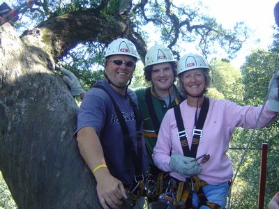
Luke and Carol pre flight, nerves just about under control

At the end of September 2006, during Luke's end of term holiday we went up the Garden Route to the Tsitikamma forest and tried out a canopy tour. Canopy tours basically mean flying from one tree top to another along a steel wire. You are at times 40 meters from the ground, but all the veitation doesn't make you feel exposed. The slides, and there are 10 in all, vary in length, the longest being 91 meters, its also fair to say that some are faster than others.
Carol crosses a rope bridge half way through the trip...no one told us about this at the start!
Carol half way along the longest slide at 91 meters
Carol ahngs on for her life at every opportunity
Last but one slide, hey hang on we are starting to like this
Our accommodation in the heart of the forrest, this was the honeymoon cottage which came complete with a bed seattee in the living room and a cot in the bedroom. What sort of honeymooners do they get around here?
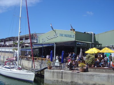
After our adventure we spent the next day recovering and looking around Knysna and in particular the Heads, which is an inlet from the sea into the Knysna lagoon. When we were there it was very rough seas and we were amazed to see a sailing catamaran makingits way out through the heads into the open sea.
We liked Knysna, we liked it so much we opened a restaurant there.

In Tsitikamma you will also find the worlds highest bungy jump, here is a shot of the bridge off which you bungy.


On Land...On Sea...On Foot...On Bikes...On Harley's...On 4 wheels...Places to see places to go...visits, stops, weekend breaks, holidays...On Land...On Sea...On Foot...On Bikes...On Harley's...On 4 wheels...Places to see places to go...visits, stops, weekend breaks, holidays...On Land...On Sea...On Foot...On Bikes...On Harley's...On 4 wheels...Places to see places to go...visits, stops, weekend breaks, holidays...On Land...On Sea...On Foot...On Bikes...On Harley's...On 4 wheels...Places to see places to go...visits, stops, weekend breaks, holidays...On Land...On Sea...On Foot...On Bikes...On Harley's...On 4 wheels...Places to see places to go...visits, stops, weekend breaks, holidays

Doing it Limpopo style


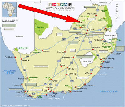
At 5am on Thursday 20th July 2006 my best mate John Mason and his son James arrived in Cape Town, the reason... James was about to start a 12 month course at the Bush Academy in Limpopo training to become a field guide. The course is 12 months long, the first 6 spent at the academy and the next 6 at one of South Africa's many game parks and lodges, getting vital work experience.

On their arrival there was frantic buying of kit and then on Sunday 23rd July John, James and myself flew from Cape Town to Joburg and then drove up to the Academy in Limpopo.

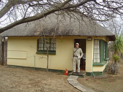
Having got James settled in his new cottage with his new uniform,

John and I departed for the comforts of the Palace Hotel in Sun City where we spent two nights.

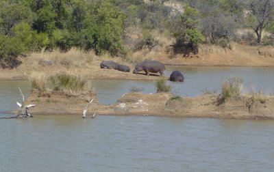
We visited James on the Monday to make sure he was okay and spent the rest of the time in Pilannesberg Game Park looking at the animals but sdaly not spotting any elephants, although we did see 7 lions.

We returned to Cape Town late on Tuesday night and John flew back to the UK early Thursday morning the 27th July 2006

At present James is doing well at the academy, is learning to drive 4 x 4's and has seen many animals on the private game reserve in which the academy is based.

James has his own blog click HERE to visit it.